When the Sun gets noisy, Earth’s technology feels it. Solar flares and coronal mass ejections can bend radio paths, rattle satellites, and drive currents through long power lines. Phones still ring and lights mostly stay on, but the stress shows up in the edges: GPS fixes drift, timing signals stutter, polar flights reroute, and high-frequency radios go quiet. With the current solar cycle peaking, it’s a good time to learn how to read space weather, what breaks in real life, and the specific steps that keep your work and home systems steady.
What a Solar Storm Actually Is
Space weather is not one thing. It’s a bundle of related phenomena driven by activity on the Sun. You’ll see a few key terms:
Flares, CMEs, and High-Speed Streams
Solar flares are bursts of X-rays and extreme ultraviolet light. They arrive at Earth in about eight minutes and can disrupt the ionosphere, the thin, electrically charged layer that reflects and refracts radio waves. This is why a big flare can cause a sudden radio blackout.
Coronal mass ejections (CMEs) are giant bubbles of magnetized plasma. They travel slower—typically one to three days—and are the main driver of geomagnetic storms. When a CME’s magnetic field is oriented just right (often southward) relative to Earth’s field, energy couples into the magnetosphere and drives currents that change magnetic fields at the surface.
High-speed solar wind streams flow from coronal holes and can buffet Earth’s field for days. They’re less dramatic than a CME but can produce persistent disturbances and auroras, especially at higher latitudes.
The Indices You’ll See in Alerts
Space weather forecasts use compact scales so busy people can act without decoding physics:
- R1–R5 for radio blackouts (from weak to extreme), tied to X-ray flux and flares.
- S1–S5 for solar radiation storms (affecting high-frequency communications and avionics at high latitudes).
- G1–G5 for geomagnetic storms (from minor to extreme), driven by CMEs or high-speed streams.
- Kp index (0–9) as a global measure of geomagnetic disturbance. Think of Kp 5 as “stormy,” Kp 7 as “serious high-latitude effects,” and Kp 8–9 as “expect widespread issues at high and some mid-latitudes.”
These scales are designed for action, not panic. They map directly to likely service interruptions (radio fadeouts, degradation to GPS accuracy, or transformer stress).
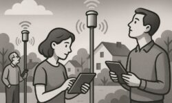
Where You Feel It First: GPS, Timing, and Radio
We depend on signals from space. GPS and its sister constellations (GLONASS, Galileo, BeiDou) make maps work, calibrate cellular networks, and keep finance and power systems in sync. The same ionosphere that helps long-distance radio also alters satellite signals in complex ways during storms.
Positioning vs. Timing: Two Different Dependencies
GNSS does two jobs. It tells you where you are, and it gives you the time. The timing part is usually more critical for infrastructure. A storm can cause “scintillation”—rapid changes in signal phase and amplitude—leading to lost lock on satellites and position errors. For timing, scintillation or ionospheric delays can scramble the precise corrections used by sensitive receivers.
What helps:
- Dual-frequency receivers (like L1 + L5) handle ionospheric delay better than single-frequency units. If you rely on timing or high-precision positioning, dual-frequency is worth it.
- Multi-constellation support improves resilience. If one constellation’s geometry is poor or signals are fading, others can fill the gaps.
- Holdover oscillators (OCXO or better) in timing equipment can ride through outages without large drifts. For IT networks, combine a local Grandmaster Clock (PTP) with GNSS and NTP fallbacks.
- Local corrections like RTK from your own base station can remain stable even when wide-area corrections degrade, because the baseline is short and sees similar ionospheric conditions.
- Offline maps and cached routes stop a minor GNSS wobble from becoming a navigation crisis for vehicles and handhelds.
Radio Services: HF, VHF, and the Satellite Gap
Radio is affected differently by space weather depending on frequency.
- HF (3–30 MHz) bounces off the ionosphere and can go worldwide—or nowhere—depending on conditions. A strong flare (R3+) causes sudden ionospheric disturbances that absorb HF on the dayside. During geomagnetic storms, the usable HF bands shift. Operators replan frequencies or switch to NVIS or relays.
- VHF/UHF line-of-sight systems are less affected by ionospheric disturbances. However, satellite links in these bands can suffer from scintillation near the equator and high latitudes during storms.
- Satcom and GNSS share the same vulnerability: a disturbed ionosphere. Redundancy across bands and paths—like HF backup for polar flights or fiber alternatives to satcom where possible—reduces risk.
For organizations, path diversity matters. If your critical communications rely on one band and one path, space weather turns into a single point of failure.
Power Grids and Long Metal
Geomagnetic storms induce slowly changing electric fields in the ground. Long conductors, such as transmission lines and pipelines, pick up these fields, driving geomagnetically induced currents (GICs) that can push transformers into partial saturation, heating them and consuming reactive power.
Most storms cause operational headaches, not blackouts. Utilities monitor transformer temperatures and reactive power margins and can reduce transfers or reconfigure networks during forecast G3–G5 events. The risk is greatest near high-latitude regions and in areas with resistive ground geology.
What Utilities Do
- Real-time GIC monitoring at substations to see currents rise during a storm.
- Series capacitors in some lines interrupt DC-like GIC flow.
- Operating procedures to manage voltage and thermal limits, including preemptive load balancing and reactive reserves.
- Transformer design improvements and standardized testing to handle GIC stress better than older fleets could.
For households and small businesses, standard surge protectors don’t address GICs because they operate on very slow timescales compared to lightning. The practical step is awareness: know your utility’s space weather protocols and keep normal outage preparedness in place (battery backups, UPS for routers and servers, and a plan to ride out a few hours without precise time sync).
Airlines, Ships, and Precision Agriculture
Some sectors meet space weather every day and treat it like any other environmental variable—plan, monitor, adapt.
Airlines
At high latitudes, solar radiation storms and radio blackouts degrade HF communications and increase radiation exposure slightly for crew and passengers on polar routes. Airlines sometimes reroute, add fuel, or switch communications methods. The cost is a delay or longer path, not a safety compromise. Flight ops teams watch the R/S/G scales, Kp estimates, and HF conditions to plan alternates.
Maritime
Ships use multi-constellation GNSS, inertial systems, radar, and visual aids. During strong ionospheric disturbance, position confidence drops. For regulated waterway transits, pilots rely on redundant systems and time windows. There’s renewed interest in complementary terrestrial timing and positioning like eLoran, which is resistant to space weather, as a backup where deployed.
Precision Agriculture
Farm equipment depends on centimeter-level positioning for planting and harvesting. Wide-area corrections (PPP or SBAS) can degrade as the ionosphere churns. Many farms maintain a local RTK base station that provides highly accurate corrections over a few kilometers, which often stays reliable even in storms. The step-up investment pays back in fewer stoppages during peak windows.
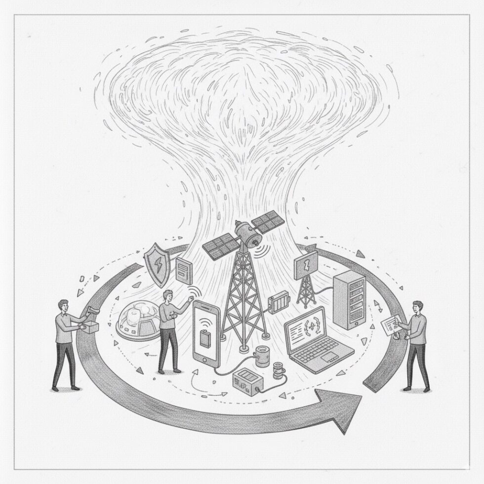
Build a Storm‑Smart Stack
Resilience is less about exotic hardware and more about layering simple safeguards. You can build a “storm-smart” stack for home tech and business ops in a week.
For Households and Small Teams
- Subscribe to alerts from a national space weather service. Pick thresholds that matter (e.g., notify at G3+ or R3+).
- Cache essentials: offline maps, key documents, and procedures on devices you’ll have during an outage.
- Redundant time sources: let your core devices use internet NTP if GNSS time drops. A cheap OCXO-based time server plus router UPS is inexpensive protection.
- Communication options: maintain at least two paths—cellular and Wi‑Fi, or satcom for remote areas. For hobbyists or volunteers, learn basic HF/VHF operation and local repeater coverage.
- Power basics: a modest battery for routers and a laptop keeps work going through brief outages, and a surge‑protected power strip narrows routine risks.
For IT and OT Managers
- Time sync architecture: use PTP inside the LAN with a GNSS disciplined grandmaster that has good holdover. Add NTP from multiple internet sources and verify with monitoring. Alert when offset grows beyond your SLA threshold.
- GNSS receiver diversity: dual‑frequency, multi‑constellation with antenna siting that maximizes sky view. Consider a second antenna feed on a separate roof position if multipath is a risk.
- Operational runbooks: define actions at alert levels. Example: “At G3, switch to holdover mode and pin trading systems to internal time; suspend non‑critical firmware updates that depend on precise timing.”
- Network path diversity: ensure WAN failovers do not share the same dependency (e.g., avoid two paths that both rely on a timing‑fragile satcom link).
- Test days: simulate loss of GNSS time and degraded GPS quality. Confirm monitoring catches it and fallbacks engage cleanly. Save logs and refine thresholds.
Forecasts You Can Actually Use
Forecasts for space weather are improving but not perfect. Think of them as guidance with uncertainty bands, similar to hurricane cones but faster-moving and less certain.
Nowcasting and the “Last 60 Minutes”
Spacecraft like DSCOVR sit at the L1 point, roughly a million miles sunward, giving a heads-up window of 15–60 minutes as solar wind parameters stream in. If the interplanetary magnetic field turns south and speed climbs, we know coupling with Earth’s field will intensify shortly. For operations teams, this “last hour” is when you flip systems to their cautious modes.
The Day-Ahead View
When a CME launches, coronagraphs on SOHO and STEREO image the expanding cloud. Analysts estimate its speed and direction to project an arrival window. Day-ahead forecasts guide staffing, grid readiness, and flight planning. The forecast products you can use:
- 3-day forecast: simple narrative plus the expected probability of R/S/G events, updated regularly.
- Kp predictions: plots with uncertainty; Kp≥7 is a cue for high-latitude operations to prepare workarounds.
- HF radio maps: show expected absorption and usable frequencies. Handy for aviation and amateur radio networks.
Data and Tools You Can Hook Into
Even small teams can automate alerts and responses without building a big system.
Feeds and APIs
- NOAA SWPC: alerts, Kp estimates, solar wind, and event summaries. Simple RSS and JSON feeds make it easy to tie into chatops or on‑call systems.
- ESA Space Weather Service Network: regional indices, auroral forecasts, and tailored products for aviation, power, and GNSS.
- National services like the UK Met Office Space Weather provide regionalized guidance and training materials.
Practical Automation Ideas
- Ops chat alerts: pipe G3+ or Kp≥7 alerts to a channel with a runbook snippet pinned.
- Time server state change: when GNSS flags holdover, raise a ticket and notify data owners. Log how long until offsets breach requirements.
- Farm operations: schedule guidance-critical passes during calmer windows; rely on your RTK base when wide-area corrections wobble.
- Grid operations: ingest GIC estimates to dashboards; preposition reactive reserves when forecast confidence is high.
Technology That’s Improving Resilience
We’re not stuck with the same fragility forever. A few trends are making life easier during storms:
- Dual‑frequency L5 rollout: modern GNSS receivers use L5, a more robust signal that improves ionospheric correction. Multi‑band phones and timing receivers get less jumpy under stress.
- Better holdover: compact OCXO and even chip‑scale atomic clocks are now affordable for critical timing nodes, turning a brief loss of satellites into a non‑event.
- Complementary terrestrial systems: testbeds for eLoran and regional terrestrial beacons are growing, offering backups for navigation and timing.
- Smarter forecasting: new models blend solar imagery, in‑situ solar wind data, and ground magnetometers. Early machine‑learning approaches help identify CME arrival windows and nowcast ionospheric irregularities, sharpening those last‑hour decisions.
- Utility hardening: modern transformer designs and GIC-blocking strategies, combined with playbooks learned from past storms, reduce the chance a big storm becomes a big outage.
Myths to Drop So You Can Focus
Space weather is dramatic enough without myths getting in the way.
- “A big storm will shut everything down for months.” Severe storms are serious, but most effects are patchy and time-bound. Think degraded services and reroutes, not a universal blackout.
- “There’s nothing you can do.” There’s plenty. Redundancy, holdover, offline caches, and clear runbooks turn surprises into speed bumps.
- “Only high-latitude areas are affected.” High latitudes see more intense effects, but equatorial regions can get strong ionospheric scintillation too, hitting GNSS performance locally.
- “Surge protectors solve grid issues.” They don’t. GICs are slow currents; mitigation lives at the grid scale. You still want UPS and routine outage prep at the consumer level.
A Simple Playbook by Role
If You’re a Home Power User
- Install device updates when weather is calm; some gear behaves badly if time jumps during upgrades.
- Keep a small UPS on your router and a laptop. A 1–2 hour cushion covers many grid wobbles.
- Enable offline maps on your phone and set your navigation app to cache frequent routes.
If You Own Field Equipment
- Put a dual‑frequency, multi‑constellation GNSS receiver on vehicles used for precision tasks.
- Use your own RTK base station if you depend on centimeter accuracy during narrow work windows.
- Bookmark your regional HF/VHF comms alternates and test them quarterly.
If You Run IT/OT
- Deploy PTP with a good holdover clock. Cross-check with multiple NTP sources.
- Write a two-page storm runbook: alert thresholds, system toggles, comms fallbacks, contacts.
- Practice loss of GNSS time twice a year. Measure drift, tune thresholds, and update dashboards.
How to Read a Space Weather Alert Without Overreacting
You get a push notification: G3 geomagnetic storm watch. What now?
- Check timing dependencies: If you run anything that needs sub‑microsecond sync, warm up holdover and pin critical apps to internal time.
- Review comms: If you operate at high latitudes, consider alternate HF frequencies or plan for satcom degradation.
- Note the window: Watches announce a possible window; warnings indicate onset. Scale your response accordingly.
- Set a reminder: Reassess after the expected CME arrival window passes. Most action items are temporary.
The Big Picture: Managing a Predictable Kind of Unpredictable
Storms aren’t rare flukes. They are part of the rhythm of the Sun, and we can manage them the way we manage hurricanes or winter storms—by understanding how they work, building layered defenses, and practicing the pivots. The tools are simple: multi‑path connectivity, resilient timing, clear procedures, and a short list of trusted data sources. The payoff is a calmer response when headlines get loud.
Summary:
- Solar flares, CMEs, and high-speed streams drive different kinds of disruption; G/R/S scales tell you what to expect in plain language.
- GNSS struggles during ionospheric disturbances; dual-frequency, multi-constellation receivers and good holdover reduce the pain.
- HF radio can fade during flares and shift during storms; path diversity across bands and links is your friend.
- Grids manage GICs with monitoring, procedures, and hardware; consumers focus on UPS and routine outage readiness.
- Airlines, ships, and farms plan around storms using alternates, local corrections, and layered navigation.
- Use alerts and Kp forecasts to trigger runbooks; the last 60 minutes from L1 monitors help time critical actions.
- Resilience is improving: L5 GNSS, better holdover, complementary terrestrial systems, and sharper forecasts.
- Build a storm‑smart stack: redundant time sources, cached essentials, multi‑path comms, and practice drills.