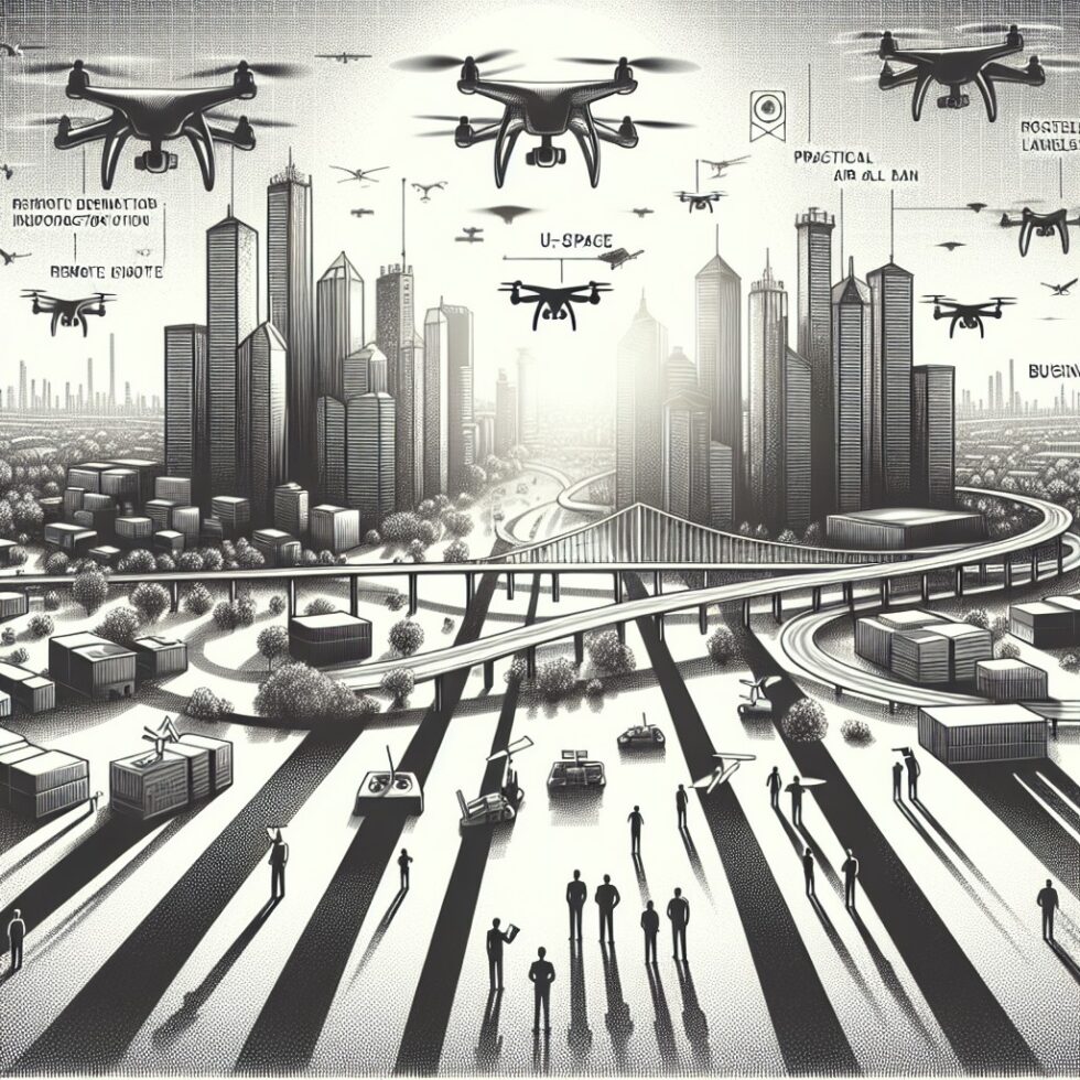
Why “Digital Sky” Matters Now
Drones are shifting from fun flying cameras to everyday utility machines. They inspect roofs after storms, check cell towers, survey land, and deliver small items. What’s changing fast is the infrastructure around them. Airspace is turning digital. The same way roads have lanes, speed limits, and traffic reports, the low sky is getting rules and live services that make routine flights predictable.
This article explains how that digital sky works. We’ll make sense of Remote ID (the license plate in the sky), U‑space/UTM services (the traffic coordination layer), and what cities and businesses can do today to fly more often with fewer surprises. If you’re planning inspections, deliveries, or just keeping a compliant fleet, this is your practical field guide.
The Building Blocks: Remote ID, UTM, and Airspace Services
Remote ID: A license plate that broadcasts itself
Remote ID (RID) is the basic ingredient of the digital sky. A RID‑capable drone broadcasts who it is and where it is, so others can know. Think of it as a digital license plate, visible to nearby receivers.
Two common ways to comply:
- Standard Remote ID drones with built‑in broadcast. The drone transmits its identifier, position, speed, altitude, and the location of the control station.
- Broadcast modules added to older models. These transmit the drone’s ID and position, and the operator’s takeoff location.
The broadcast uses Bluetooth or Wi‑Fi signals most phones can “hear” with the right app. Observers see a unique identifier (often the drone’s serial number, or a session ID that maps back to it through a service). In certain areas called FRIAs, approved clubs can fly legacy aircraft without RID. Otherwise, RID is now table stakes for operations in most public airspace.
Why it matters: RID gives situational awareness to other airspace users, enforcement, and bystanders. It also unlocks higher‑trust services. If software can verify who’s flying, it can make smarter decisions about flight planning and conflict avoidance.
U‑space/UTM: The traffic layer for drones
On the ground, traffic lights and navigation apps help us move without colliding. Drones need their version too. That’s what U‑space (in Europe) and UTM (Uncrewed Traffic Management, a more global term) provide.
Think of U‑space/UTM as a set of digital services:
- Flight authorization: Simple, fast approvals to fly in controlled airspace volumes.
- Strategic deconfliction: Checking your planned route against others before you fly.
- Tactical conflict alerts: Live nudges if another drone is getting too close.
- Geozone awareness: Updated no‑fly zones, temporary restrictions, and advisories.
- Conformance monitoring: Flagging when a drone drifts from its approved plan.
In practice, operators use an app or platform connected to a UTM/U‑space service supplier. You file a plan, get clearances, see advisories, and maintain awareness during flight. Behind the scenes, these systems exchange data through open standards so different providers can coordinate across a region.
How to Fly Legally and Predictably Today
United States: Part 107 with digital helpers
In the U.S., most commercial work happens under Part 107. Key pieces to set up:
- Remote Pilot Certificate: Study airspace classes, weather basics, and crew responsibilities. Maintain currency with recurrent training.
- Remote ID: Use a standard RID drone or add a module. Keep firmware updated and test broadcasts before field work.
- Airspace authorization: For controlled airspace near airports, request authorization with LAANC in an approved app. Approvals arrive in minutes for most routine flights under 400 ft AGL.
- Operations rules: Night flights require anti‑collision lighting and training. Operations over people depend on your drone’s weight and design. Some aircraft can qualify under specific categories or with approved parachute systems.
Some work needs waivers—like flights beyond visual line of sight (BVLOS) or flying higher than 400 ft AGL away from structures. These waivers usually require extra mitigations: strong detect‑and‑avoid, robust command links, and clear procedures.
European Union: Open, Specific, and U‑space
The EU uses three risk‑based buckets:
- Open (A1/A2/A3): Lower‑risk operations with class‑marked drones (C0–C4). Limits include staying close to people in specific conditions and flying below 120 m AGL.
- Specific: Higher‑risk missions approved with a conops and a SORA (Specific Operations Risk Assessment). Many commercial inspections and delivery pilots live here.
- Certified: Very high risk, similar to manned aviation certification.
U‑space airspace can be designated in busy regions to add services: network identification, flight authorization, traffic info, and conformance monitoring. Operators file and fly through a U‑space service provider for those volumes. As with the U.S., Remote ID and geozone awareness are fundamentals.
What’s common across regions
Regardless of country, you’ll need three pillars:
- Airworthiness and fail‑safes: Reliable power, healthy props and motors, and tested return‑to‑home logic. For operations over people, many teams add a certified parachute.
- Airspace awareness: RID working, geozone data loaded, and manned traffic awareness (often with ADS‑B In on the tablet or aircraft).
- People and procedures: A trained pilot, a visual observer when needed, and clear checklists. Keep a simple “as‑flown” log after each mission.
From Single Flights to Scalable Operations
Tooling that reduces friction
When flights become routine, the bottleneck is not airframes; it’s workflow. The right tools make your operation predictable:
- Fleet management: Track firmware, batteries, prop life, and maintenance. Store airworthiness checks that map to your SOPs.
- Mission planning: Preload geozones, terrain, and obstacles. Use ridge‑aware path planning to maintain line of sight and link quality.
- Detect‑and‑avoid inputs: ADS‑B In for manned traffic, Remote ID receivers for nearby drones, and optional ground radar for dense areas. Even a tablet app that shows manned aircraft helps the pilot make faster calls.
- Command links that fail gracefully: Dual‑band radio plus LTE/5G fallback for supervised autonomy. Map dead zones on your sites and plan alternate routes.
Data you should monitor
You do not need a data science team to gain value. Start with a few useful feeds:
- Micro‑weather: Wind gradient near structures, gusts, temperature, and precipitation. It’s amazing how often micro‑gusts surprise pilots at building corners.
- Link health: RSSI and latency over distance. Build a simple curve for your sites so you know when to add a repeater or plan a different orbit.
- Battery health: Cycle count, internal resistance, and recovery time after heavy draws. Proactively retire packs before they cause mid‑mission stress.
- Geozone deltas: Get alerts when restrictions change around your sites. A new crane or temporary flight restriction can appear overnight.
People and procedures
Even with automation, humans hold the safety margin. Good habits you can adopt fast:
- Briefings: What we’ll do, where we’ll fly, who calls “abort,” and the safe landing areas.
- Go/No‑Go checklist: Weather, NOTAMs, batteries, firmware, and mission plan validation.
- Incident drills: What happens if link drops, a prop chips, or a curious person walks into the launch zone? Practice the calls now.
Delivery and Emergency Lanes: How Air Corridors Actually Work
Defining a corridor
A drone corridor is a virtual band of air with clear constraints. To stand one up, you model three layers:
- Vertical limits: A floor and ceiling that avoid cranes, trees, and wires. This may include “preferred altitudes” based on wind and noise profiles.
- Lateral shape: A 3D tube above safe ground routes. Avoid sensitive sites like schools or hospitals unless you’re serving them with explicit approvals.
- Buffers: Extra room for navigation errors, gusts, and GPS multipath around buildings.
Technically, this corridor is a polygon with altitude bands in your UTM planning tool. The service checks other plans against it and keeps everyone informed. Local authorities can publish “geozones” and “letters of agreement” to reserve or schedule these volumes for tasks like medical deliveries or post‑storm inspections.
Interoperability and open standards
If drones from different companies are to share the same sky, their systems must talk. That’s why UTM and RID lean on published, open standards. Interoperability lets a flight plan filed in one app be visible to another provider for strategic deconfliction. It also supports “conformance monitoring” across vendors, so a city dashboard can see who’s on plan.
Tip: When you evaluate software, ask how it implements open standards for RID and UTM messaging. The ability to interop will matter more as volume grows.
What cities can do now
Cities and counties don’t control airspace, but they do shape where drones can take off and land, and how residents learn about operations. Practical steps:
- Publish launch/landing spots on city GIS with constraints (hours, noise rules).
- Share planned public operations on a web map. Transparency builds trust.
- Coordinate with utilities and first responders to pre‑approve “emergency corridors.” When storms hit, teams won’t waste hours seeking one‑off approvals.
- Encourage standard tech in RFPs. Require RID, UTM interoperability, and privacy by design for any city‑contracted flights.
Privacy and Transparency, Without Drama
RID raises fair questions: What does the public see, and how much detail is too much? The good news is the system can balance awareness with privacy.
- Session IDs: Instead of a permanent serial, a rotating ID can be broadcast. This still allows authorized systems to verify the aircraft, but casual observers don’t get a stable identifier to track you across days.
- Minimal necessary data: Broadcast only the data required by law. Store full logs securely, and share more detail only with authorized parties.
- Public dashboards: For recurring routes (like medical deliveries), a simple web map that shows normal operating hours and general paths can reduce confusion. No need to stream every coordinate to the world.
Bottom line: Be transparent about the what and why. Limit the who and exact where to authorized tools.
Hardware Buyers’ Notes: What Actually Matters
Remote ID capability and failsafes
Choose airframes with native RID support, redundant sensors, and sane failsafes. For delivery or over‑people work, check if a compatible parachute system has test data for your model. Test return‑to‑home under different wind and GPS conditions. A smart drone is one that lands safely when things go wrong.
Command links and antennas
Most operations use 2.4/5.8 GHz links. Urban canyons and interference can eat your range. Tips:
- Antennas: Use high‑quality, well‑seated antennas. Keep them free of cracks and moisture ingress.
- Directionality: For fixed‑site flights, directional antennas on the ground can improve link margin along a corridor.
- LTE/5G fallback: For supervised autonomy and longer corridors, a cellular link can carry telemetry. Plan for dead zones and design conservative failsafes.
Maintenance you can’t skip
Propellers, motors, and batteries fail more often than radios. Replace props at the first nick, track motor bearing noise over time, and keep batteries in storage charge between missions. Treat battery logs like a flight diary; they quietly forecast your next surprise.
BVLOS and Detect‑and‑Avoid: The Edge of Routine
Detect‑and‑avoid options
For flights beyond visual line of sight (BVLOS), you need to prove you can avoid other traffic and keep risks low on the ground. Options include:
- ADS‑B In: See nearby manned aircraft. Helpful, but you still need a policy to act on the data.
- Ground‑based sensors: Radar or optical systems watching your corridor. Good for fixed routes near airports or towers.
- Onboard sensing: Cameras, lidar, or acoustic arrays that detect and classify intruders.
- Procedural mitigations: Preplanned holds, altitude layers, and climb/descend behaviors that buy time.
Most teams mix two or three methods plus procedures to earn approvals. Start with supervised flights along a single corridor and build confidence with data.
Command‑and‑control reliability
BVLOS flights also require a robust command link. Design with margin:
- Link budgets: Model worst‑case path loss for your route. Add extra margin for rain fade and foliage.
- Fallbacks: If LTE drops, do you have a safe loiter and return profile? If GNSS glitches, can you hold position using vision or lidar?
- Graceful degradation: Predefine when to reduce speed or climb to a safer transit altitude if telemetry degrades.
A Simple Starter Blueprint for Small Teams
Want to get from “we own a drone” to “we run a dependable drone program” in a month? Use this tight plan:
- Pick a mission you repeat often: rooftop inspections, inventory yard scans, or pharmacy courier.
- Choose two airframes that are RID‑capable and share batteries and parts. Keep a common spares kit.
- Write a one‑page conops: launch site, route, altitudes, abort points, and safe landing zones. Keep it simple.
- Set up your digital stack: a LAANC‑capable app (if in the U.S.), geozone data, a micro‑weather source, and a logbook. Test RID broadcasting and decoding with a smartphone app.
- Train your crew: pilot and one visual observer. Practice comms, callouts, and a mock incident.
- Fly three dry runs with no payload. Measure link and battery margins. Log wind at altitude vs. ground.
- Hold a review: What surprised you? Update the conops, add buffer to altitudes, and nudge the route away from tricky spots.
- Go live with limited hours. Add a simple public webpage that explains the what/when/why in plain language.
- Automate the dull parts: checklists in your app, auto‑generated “as‑flown” logs, and scheduled battery health checks.
- Scale slowly: add a second route or shift only when the first feels boring—in a good way.
Noise, Safety, and Community Buy‑In
Noise is a top complaint. You can lower it with smarter planning:
- Altitude: Higher isn’t always quieter, but it spreads the footprint. Test with a meter in your corridor.
- Prop choice: Some models offer low‑noise props with different blade geometry. Verify cooling and climb performance after you switch.
- Time windows: Avoid early mornings and late evenings near homes unless it’s an emergency corridor.
Safety drills also earn trust. Notify nearby facilities before early flights, carry a visible ID at operations, and use cones or a small barrier around launch points. When people see a pilot who looks prepared, they relax.
What’s Next: From Piloted Missions to “Drone‑in‑a‑Box”
We’re on a path from piloted outdoor flights to semi‑permanent stations that launch and recover drones automatically—often called “drone‑in‑a‑box.” As RID and UTM services mature, these systems can file, fly, and report with minimal human steps. Expect three near‑term shifts:
- More designated corridors for deliveries and inspections, especially where roads are congested or fragile after storms.
- Cross‑vendor visibility: Interoperable standards mean a city can see activity from multiple providers on one screen, with privacy controls in place.
- Better small‑weather: Hyperlocal forecasts improve go/no‑go calls and reduce aborted missions.
The digital sky is not a single product. It’s a set of simple, shared rules and live feeds that make flying boring—in the best way possible. When your air operation feels dull and predictable, you’ve done it right.
Summary:
- Remote ID is the drone world’s license plate, enabling awareness and trust for routine flights.
- U‑space/UTM services provide planning, authorization, geozone updates, and conflict management.
- In the U.S., Part 107 plus LAANC and RID form a practical baseline; in the EU, Open and Specific categories plus U‑space apply.
- Scalable programs focus on workflow: fleet management, mission planning, detect‑and‑avoid inputs, and maintenance.
- Corridors are 3D lanes with altitude, lateral shapes, and buffers; cities can help with launch sites and transparency.
- Privacy can coexist with awareness using session IDs and minimal broadcast data.
- BVLOS needs robust detect‑and‑avoid and reliable command links, often with multiple layers of mitigation.
- A simple, repeatable blueprint helps small teams go from occasional flights to dependable operations.
External References:
- FAA: Remote Identification of Unmanned Aircraft
- FAA: Low Altitude Authorization and Notification Capability (LAANC)
- EASA: Specific Operations Risk Assessment (SORA)
- ASTM F3411: Remote ID Standard (Overview)
- ASTM F3548: UAS Traffic Management Interoperability (Overview)
- ASTM F3322: Parachute Recovery Systems (Overview)
- DJI FlySafe: Geofencing and Safety Zones
- Wing OpenSky: Airspace Awareness App
- Altitude Angel: UTM and Airspace Services