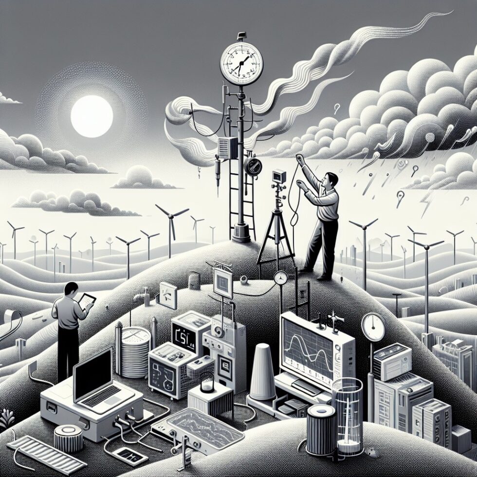
Weather apps are fine for a citywide guess. But when it comes to rain on your street, wind on your rooftop, or heat in your backyard, you need details your phone cannot see. A hyperlocal weather network fills that gap. One or more stations feed high‑quality data into a small, maintainable pipeline. You can alert neighbors about sudden downpours, skip irrigation with confidence, and understand how your microclimate behaves across seasons.
This guide shows how to design and run a practical neighborhood weather network: the station hardware that holds up, siting practices that prevent bad readings, data quality checks that keep your charts honest, and simple nowcasting to predict the next hour. We keep the tooling clear, the jargon light, and the steps actionable. By the end, you will know how to build something that runs for years, not weeks.
What “Hyperlocal” Really Means
On most maps, a single city has one temperature. In reality, air warms and cools over very short distances. Asphalt radiates heat. Trees cool and shelter. Hills channel wind. A hyperlocal network samples those differences so you can make better decisions about outdoor events, gardening, cycling, or school pickups.
Start with one station at your home, then add a few more on the same street or in a nearby park with permission. You don’t need ten devices to get value. One sturdy station with clean data is better than five cheap ones that drift or clog. If neighbors join later, your pipeline can ingest their feeds and improve your neighborhood picture.
Pick Hardware That Survives Weather, Not Just a Season
Weather stations range from all‑in‑one pucks to modular pro gear. Focus on accuracy, durability, and available data formats. A sleek shell is not helpful if rainfall gets miscounted when leaves stick to it, or if a summer heatwave causes wild temperature spikes.
Core sensors you actually need
- Air temperature and humidity: Prefer a shielded sensor with good ventilation. Look for a multi‑plate radiation shield or an aspirated design.
- Barometric pressure: Useful for trend analysis and storm detection.
- Rainfall: A tipping‑bucket or haptic sensor. Buckets need cleaning; haptics need careful calibration but avoid clogs.
- Wind speed and direction: Cup/propeller and vane at height, or ultrasonic on a mast.
- Optional: Solar radiation, UV, soil moisture, leaf wetness for gardening and energy use cases.
Practical, proven options
Consider these well‑known choices and compare local availability and support:
- Davis Vantage Pro2: Modular, accurate, field‑serviceable. Higher cost, but long‑term reliability. Data via local logger or hub.
- Ecowitt systems: Flexible sensor lineup, affordable, and good local data access (HTTP/MQTT). Great for tinkerers.
- Tempest: All‑in‑one with haptic rain and ultrasonic wind. Easy install. Cal depends on your site and climate.
Whatever you buy, confirm you can stream data locally. A hyperlocal network should not die if a cloud service has a bad day.
Site and Install for Trustworthy Data
The fastest way to ruin a good sensor is poor placement. Before mounting anything, walk your property at different times of day. Watch for shade, reflected heat, and wind channels. Your goal is exposure that is representative of your area—not the hottest roof tile or the most sheltered corner.
Simple siting rules that matter
- Air temperature: Mount 1.25–2 meters above short grass, over open ground. Use a proper radiation shield. Keep several times the sensor height away from heat sources (walls, stone, air vents).
- Rain gauge: Level it carefully. Place well clear of trees and walls (ideally distance > 2x obstacle height). Keep it accessible for cleaning.
- Wind: Mount at 10 meters height if possible, or the highest practical spot with minimal turbulence and away from rooflines. Document your actual height.
- Barometer: Indoors away from drafts and heating/cooling outlets, compensated to sea level using your known elevation.
- Document exact coordinates (with some privacy rounding if you plan to share), sensor heights, and surroundings. This metadata helps QC and comparisons.
You will not hit textbook siting in dense neighborhoods. That’s okay—just be honest in metadata. Classify your siting quality, and note any biases (e.g., afternoon sun reflection). Down the line you can correct readings with context instead of guessing why they seem off.
Collect, Store, and Visualize Without Lock‑In
A simple stack is enough: a station talks to a local gateway, which forwards data to a time‑series database and dashboards. Keep raw data saved. Keep corrected data separate. Never overwrite your truth source.
A clean, portable data path
- Local collector: Use WeeWX to ingest data from many station types and format it consistently. It runs well on a Raspberry Pi or small VM.
- Message bus: Optional, but helpful. Publish station updates to MQTT with JSON payloads: timestamp (UTC), units, sensor IDs, and quality flags.
- Time‑series store: InfluxDB is an easy fit. Use retention policies so your disks don’t fill. Tag by station_id, sensor_type, and siting_class.
- Dashboards: Grafana provides fast charts, alerting, and sharing. Build panels for temperature, wind, rain rate, and derived metrics like dew point and heat index.
If you prefer a vendor cloud for backup, that’s fine—just ensure your local path is first‑class. Your network should keep working during an internet outage.
Quality Control: Keep Your Curves Honest
Every sensor drifts. Spiders clog buckets. Fallen leaves fake rainfall. Quality control (QC) protects your network from these slow and sudden failures. You don’t need a research lab to get useful QC. A few checks catch most problems.
Four basic QC tests
- Range: Filter unphysical values (e.g., humidity over 100%, temperature below plausible seasonal limits for your region).
- Step: Flag sudden jumps beyond a threshold (e.g., temperature jumps 5°C in one minute is suspicious unless a front passed). Keep raw, mark suspect.
- Persistence: Detect stuck sensors (e.g., exact same value for hours). Many low‑power sensors “stall” like this.
- Neighbor check: If you have multiple stations, compare each to the neighborhood median using a robust statistic like median absolute deviation (MAD). For single stations, compare to a trusted nearby official site from a source like Meteostat.
Set QC to flag data, not delete it. Add a qc_flag field. Many issues can be cleaned after maintenance and calibration.
Calibrate simply and often enough
- Rain: For tipping buckets, do a controlled pour test. If 1000 ml should produce 50 tips but you see 46, apply a 1.087 factor. Repeat after leaf season.
- Temperature: Use a reference sensor in a shaded, ventilated shield. Compare several sunny afternoons and cool nights to find bias. Adjust metadata or apply a correction curve.
- Wind: Check mounting height in metadata. If you can’t reach 10 m, do not “correct” with arbitrary factors. State the height and accept the microclimate truth.
Keep a station log. Note cleaning, firmware updates, storms, and moves. Later, step changes in charts make sense because you have context.
Short‑Term Forecasts You Can Actually Use
Forecast models are great at the synoptic picture. For the next 0–2 hours of precipitation where you live, a simple nowcast often wins—especially for convective showers. You can combine live radar with your station’s rain rate to predict near‑term conditions that drive decisions like “Bike now or wait 40 minutes?”
Build a minimal nowcast
- Get radar tiles: Use an API like RainViewer or, in the US, process NEXRAD composites from public sources. Clip to a small bounding box around your neighborhood.
- Motion vectors: Compute optical flow or correlation between recent radar frames to estimate motion. This yields the probable path of echoes for the next 30–60 minutes.
- Extrapolate: Shift the current radar field along the motion vectors on a 5‑minute grid. Blend with decay factors to reflect weakening echoes.
- Local adjustment: Weight your station’s recent rain rate and intensity flags to adjust probabilities over your exact location.
- Output: Generate a probability‑of‑precipitation curve by minute, plus a simple “umbrella in 25–30 minutes” message.
Libraries like pysteps can handle the optical flow and extrapolation math. Start simple: motion + decay + probability threshold. Avoid overfitting. Your first goal is useful, not perfect.
Turn Data Into Decisions and Alerts
Numbers are just numbers until they push a useful action. Design small automations that reduce hassle and risk for your household or street. Keep them understandable. If an alert fires, it should be obvious why.
Practical automations
- Irrigation skip: If rain in last 24 hours > 6 mm, or nowcast PoP next hour > 60% and expected > 3 mm, postpone watering by 24 hours.
- Air quality day planning: If your outdoor humidity and temperature exceed thresholds and wind is light, alert that indoor cooling will be more efficient now than later.
- Wind safety: If gusts > 12 m/s sustained for 10 minutes, send a “patio items” alert to household members.
- Heat index and wet‑bulb: Compute derived metrics. If wet‑bulb > 28°C, flag high risk for strenuous outdoor work.
Use a home automation tool if you already have one, but keep the logic close to your data. That way, you can audit alerts and improve thresholds after real‑world use.
Share Wisely: Build a Micro‑Mesonet Without Oversharing
Sharing data multiplies its value. Neighborhoods benefit from more sites, and platforms benefit from consistent, well‑documented stations. That said, be mindful of privacy and the burden of ongoing support.
Where and how to publish
- Community platforms: Weather Underground and the Met Office’s WOW let you contribute data. Documentation and support vary, but exposure is high.
- Open APIs: Consider publishing a simple, documented JSON endpoint with your station’s observations and metadata (rounded coordinates, siting notes, height).
- Grant access selectively: If you plan to integrate with research databases or civic dashboards, use API keys and clear data licenses (e.g., CC BY 4.0).
Separate identity and place. Use a station ID and pseudonymous contact method. For maps, round lat/long to ~3 digits (~100 m) unless precise siting is necessary for research and you have consent.
Run It Like a Small Service
Think beyond the weekend project. Reliable weather networks are about steady care rather than constant tinkering.
- Maintenance cycle: Monthly quick visual check, quarterly cleaning (rain gauge, spider webs), annual calibration checks and battery refresh.
- Budget: Expect $200–$1000 for a solid station and $50–$200/year for maintenance and parts. Keep a small spare parts kit: funnels, desiccant, zip ties, anti‑bird spikes for gauges.
- Backups: Snapshot your database weekly. Export raw CSVs monthly for cold storage. Keep an offsite copy in cheap object storage.
- Uptime: Put your collector on a small UPS. If power outages are common, consider a PoE extender or a low‑power SBC to keep logging through blips.
Recruit a neighbor co‑maintainer. Two sets of eyes catch issues faster and share the load during vacations.
Avoid Common Pitfalls
Most bad data has simple causes. Here are traps to watch for and easy fixes.
- Radiation errors: Unshielded temperature sensors spike in direct sun. Use a multi‑plate shield or aspirated fan, and avoid reflective walls and decks.
- Rain gauge clogging: Leaves, pollen, and nesting insects stop tips. Add a fine mesh screen and schedule cleanouts after leaf drop and spring blooms.
- Bird and spider interference: Install anti‑perch spikes on funnels and check for webs inside gauge bodies. Webs can wick drops and fake drizzle.
- Snow undercatch: Tipping buckets underestimate in snow and wind. Note this bias in metadata, add a snow board for manual measurements, or consider a weighing gauge for cold climates.
- Wind mast turbulence: Short masts on cluttered roofs produce chaotic wind. If you can’t get clear exposure, publish your height and call it a microclimate reading instead of pretending it is “standard.”
- Time drift: Unsynced clocks break aggregates. Sync your collector device with NTP and log in UTC consistently.
Expand With Purpose
Once the basics work, you can add sensors and smarts that fit your goals. Keep additions modest and well documented.
- Soil moisture and temperature: Great for gardening and irrigation planning. Bury probes at the root zone of representative plants.
- Leaf wetness: Helps estimate disease risk windows for vineyards and gardens.
- Solar radiation and UV: Useful for PV performance tracking and shade mapping.
- Lightning detection: Good for outdoor sports scheduling; verify performance with regional strike networks.
- Neighborhood nodes: Add low‑cost satellite stations for temperature and rain to fill gaps. Use consistent metadata and QC to compare across sites.
Every new sensor is a promise to maintain and interpret it. Add slowly. Keep your network explainable.
A Simple Data Model That Lasts
Agree on a small set of fields across all stations. Consistency is more valuable than squeezing in one more decimal place.
- Station core: station_id, lat, lon (rounded if public), elevation_m, siting_class, wind_height_m, temp_height_m.
- Observation: timestamp_utc, temp_c, rh_pct, pressure_hpa, rain_mm, rain_rate_mmph, wind_avg_ms, wind_gust_ms, wind_dir_deg, solar_wm2, uv_index.
- QC flags: qc_range, qc_step, qc_persist, qc_neighbor (booleans), plus a free‑text qc_note for known issues.
With this structure, analytics and automations stay stable as hardware changes.
Case Study: From Backyard Station to Street‑Level Insight
Imagine you install a robust station on a 2‑meter pole over grass, with a shielded temperature sensor and level rain gauge. You ingest data into WeeWX, publish MQTT updates, and store everything in InfluxDB. Grafana panels show daily and weekly trends. After a month, you invite two neighbors to add Ecowitt rain and temperature nodes on their blocks.
Next, you add QC tests. One neighbor’s rain gauge shows persistence during dry spells—turns out a spider web was wicking drops. QC flags it; cleaning fixes it. Your neighbor on a south‑facing slope runs hotter on sunny afternoons; that’s real microclimate, not an error, so you describe it in metadata. You then fetch radar tiles every five minutes, compute motion vectors with a lightweight flow algorithm, and produce a 60‑minute nowcast. A garden automation skips watering on days when your nowcast exceeds a 70% chance of 2 mm of rain. Your water bill drops. Your group chat gets a polite alert: “Likely showers on Oak St. at 5:20–5:50 PM. Cover tools if outside.”
After six months, you have seasonal baselines and can spot anomalies fast. You publish a simple JSON feed with rounded coordinates. A local school reuses your data to time recess during heat waves. The project continues because it’s useful every week, not because it’s fancy.
Summary:
- Start with one reliable station that supports local data access. Add neighbors later.
- Focus on proper siting and a shielded, well‑maintained rain gauge and temperature sensor.
- Build a simple data path: WeeWX (or similar) to MQTT to InfluxDB and Grafana. Keep raw and corrected data separate.
- Use basic QC tests (range, step, persistence, neighbor) and keep a maintenance log for context.
- Combine radar nowcasting with your station’s rain rate for useful next‑hour decisions.
- Automate small actions: irrigation skips, wind alerts, and heat safety notifications.
- Share data with privacy in mind using rounded coordinates and clear metadata.
- Expand slowly with sensors that match your goals, and treat your network like a small, reliable service.
External References:
- WeeWX: Open source weather station software
- Grafana: Dashboards and alerting
- InfluxDB: Time series database
- Meteostat: Historical weather and climate data
- NOAA NEXRAD data on AWS
- RainViewer API: Global weather radar
- pysteps: Precipitation nowcasting library
- Davis Instruments Vantage Pro2
- Ecowitt: Weather sensors and consoles
- Tempest Weather System
- Met Office Weather Observations Website (WOW)